Sunday 24 May 2015

Lake Bala Area

Lake Bala Area

22nd May 2015

Another moving day today - it started grey, overcast and misty but not really any rain.  We had only got about 20 miles to travel from Dolgellau to Bala, so on the way we decided to stop off at Llanelltyd to do the Precipice Walk.  If you search for it on Tripadvisor it gives it 5 stars, and it may well have been a lovely walk, but it was so misty I think we missed most of the spectacular views!.
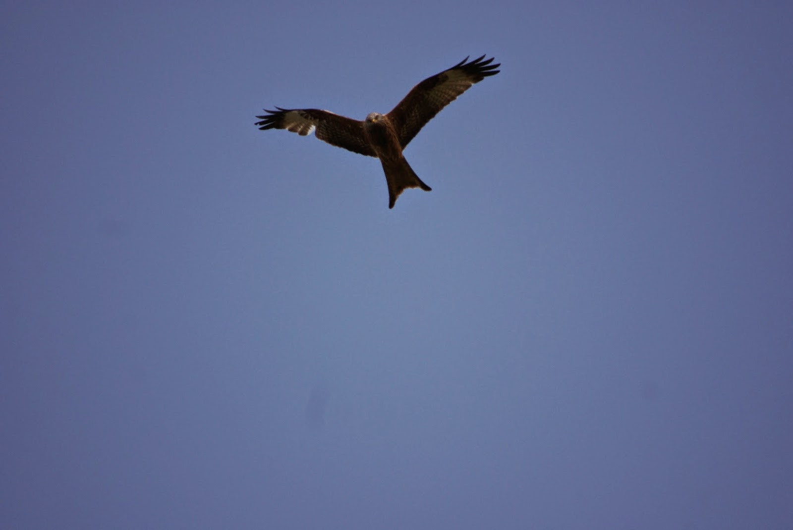
John at about 10 yards!
We continued on to Lake Bala and found Tyn Cornel concentration camp - whoops, sorry, I mean camp site.  To be fair, the surroundings are really quite pleasant but the number of signs telling us what to do and what not to do are over the top.  We are pitched beside the raging river Afon Tryweryn, that is home to Canolfan Tryweryn (National White Water Centre), and from our van our views are of low hills and open country side.  We soon learnt that the signs were not the only authoritarian way in which the camp site is managed - when we noticed the resident warden, who we christened 'The Camp Commandant'  marching up and down watching over us like a shepherd watching over his flock.  Once settled in we had a lazy afternoon in the van and kept 'The Commandant' happy by not straying very far.

PS the site is up for sale for £600,000 if anyone is interested!


23rd May 2015

Today we decided to cycle down to Bala and around the Lake.  Unfortunately, because it is Bank Holiday weekend it was very busy, and the only way down to the town is down the main A4212 where large vehicles whistled by at alarming speed.  The town of Bala was also chocka,  but eventually we managed to fight our way through and exited onto the A494 where we found a shared path that runs between the road and the lake down as far as Glan-Llyn Centre.  From here on we were back on the road but it was only a short distance till we left the main road and joined the much quieter B4403 which took us around the bottom of the lake to start our return journey back to Bala.  As the road climbed up we crossed a little bridge - Pont y Pandy - We thought this was where Fireman Sam lived but if he does he must have been out in his little red fire truck!!  However, we weren't disappointed with our ride because the the views were quite spectacular and on reaching the top of the hill we found ourselves overlooking a small Railway - Bala Lake Railway where little trains chugged in and out of the station.


Is that a train or is it a bonfire! 
We trundled on a bit further and then had a coffee stop at Llangower Point where there is a nice little beach.
The view from Llangower Point


And from there our journey continued until we stopped at the north end of Bala for lunch before nipping into town to pick up additional provisions for tea.  By this time it was about 2.30 and the streets were thronged with pedestrians and traffic - thus making it impossible to cycle so we ended up strolling with the rest of the crowds.  We then had about 4 miles to get back to the camp site, mostly over gently rising terrain so it was a nice easy ride of around 18 miles in total.
North end of Bala and our Dining Room


24th May 2015

We set off this morning to see the White Water Rafting and this was easy to access because there is a gate at the top end of the camp site which follows the river Tryweryn up to a dam and passes by the Rafting centre.  It was interesting to see the canoeists and  the rafters tackling the difficult looking technical stages and weirs, and at least while we were watching, nobody fell in!  It all looked very exciting but it definitely wouldn't be for me  - I  don't even like getting my face wet in the shower!


We followed the path as far as the dam and passed hundreds of canoeists and rafters readying themselves to take the plunge!


But then having seen all that was on offer, and as the day was still young, we decided to take a short walk up into the hills in search of a small waterfall that we had read about.  This turned out to be more of an adventure than we'd planned, and I think I will christen it 'The walk of Lost Paths'!  To start with the path was easy to follow but after passing through a gate and under the electricity grid lines all evidence of a trail vanished and we had to take repeated grid references using both phone app and ipad maps to roughly plot where we were and where we should be, and unfortunately, we got it wrong.  We ended up trekking through a dark dark wood (pine forest), which wasn't  marked on the map, but where there was a clear path that looked as if no one else had ventured there for a very long time.
John in the dark dark wood!
 When we got to the other side we climbed over a style, but after that the trail just vanished again, and as there was only a boggy field in front of us we had little idea of where to go next.  Eventually John figured out, by using his phone and ipad, that we had gone wrong and needed to back track back through the dark dark wood (spooky and no mouse found).


After retracing our steps we eventually found what we were looking for - a foot bridge over the little River Hesgyn and this became our chosen  picnic spot for today.

Following our refreshments we proceeded on our way, again trying to follow deteriorating or non existent paths and having to rely on the map to guide us.  The only evidence of footfall was from animals (mainly sheep), and in places the ground underfoot was waterlogged, which resulted in us having to find detours to avoid the worst of it.  This situation continued until we eventually reached the little lane from where we had started.  We never did find the waterfall and the walk itself was a navigational challenge, which John managed very well.


In our opinion Bala and it's surrounding areas are a lovely place, but probably better suited to people who like water sports.  There seemed very little for walkers and the only cycling we found required inclusion of long sections of main road and steep hills.

We will be going home tomorrow so The Tardis will have to de materialise again for a while.  I have 5 more weeks to work before I retire (from my 38 year career in Nursing) on the 4th July (Independence Day), and even after that, we may be held back from pursuing our goal of going full time in our van because we still haven't sold our house.  However, this is still a work in progress and we will keep the blog updated when we have anything interesting to report x 👋


Click here to see Our UK Camping Spots

Thursday 21 May 2015

Another big Mountain

Another Big Mountain

19th May 2015

Not much to report today.  We left St. David's and headed north to Dolgellau, stopping off for shopping at Lidl on the way.  We are staying on a Caravan Club certified location at Abergwynat Farm, which we thought we would miss out on, because when we tried to book they said there was no room.  However, then they offered us The Paddock as an alternative, so we quickly accepted.  This turned out to be a lovely little walled area by the side of a babbling brook where two vans can park but we had it all to ourselves.
Our private little spot

The drive leading to our private little spot


From this camp site we knew we could access both Cadair Idris and The Mawddach Trail so it was ideal for our requirements for the next two days.  Once we had set up camp, after a very tight squeeze through the gates (inches to spare on either side), we had a quick cuppa and then went for a little walk along the trail towards Penmaenpool toll bridge with the intention of stopping at the pub for a quick pint, but as neither of us had thought to pick up any money  our plan failed.  Never mind, we did a quick scurry back to the van for dinner and a glass of pop.


20th May 2015

Today was the big one!!  We left the camp site loaded with food, water and warm clothing and headed up the drive, then across the road and up an increasingly steep hill towards the Youth Hostel which sits in Cadair Idris's  forbidding shadow.  The road and then the path followed a fast flowing river that tumbled over numerous rocks and fallen trees and wended it's way through  ancient woodland past Tynyceunant Farm and eventually led us onto another road.    Immediately across the road was the track that was going to lead us to the Pony Path, which was our chosen route up Cadair Idris.

This first part of the route proved doubly difficult  due to it's extreme steepness and the previous day's rain running down the hillside in torrents.  At this early stage I think we both suffered doubts as to whether we could make it all the way, but we persevered  and once we found the Pony Path, the terrain eased with the help of the stones that had been set out to reduce erosion and keep hikers on the correct trail.  However, the trail was still unrelenting in it's steepness, and in parts, marked only by cairns over very rocky ground.  We went onwards and upwards until we came to the last few hundred yards which became a scramble where you needed to use hands and feet to progress, and by this time the wind was picking up and it was quite cold, but undeterred we finally reached our goal and scrambled over  the rocky scree to the trig point for photos.


Whoops, we had to have separate ones cos we forgot our selfie stick!!

We had a quick look round and took a few more photos of 'views' and then started back down with a plan to get out of the wind so that we could sit and enjoy our hot soup and cake.


Out towards Barmouth

Cadair Idris Summit

Cadair Idris, Mynydd Moel and Gau Graig


Following said break we made our way downhill, which was almost as difficult as climbing up due to the loose scree and sticking out rocks that were ready to trip you up if you were distracted even for a second by the amazing views...
Me 'tripping' down the hill
From here on it was just a matter of retracing our steps back to the Tardis and by the time we got there we were both more than ready to put our feet up and relax for the rest of the evening.  We estimate that the walk was approximately 10 miles in length but with all the ups and downs it seemed further.


21st May 2015

Today was a recovery day with a nice relaxing cycle ride (just a little 28 miles!) along the lovely Mawddach Trail.  Again, we set off from the camp site and joined the trail about half way along it's length.  We headed towards Barmouth but we got sidetracked by a new path which lead to Fairbourne.


This took us across salt marshes where sheep stood knee deep in the water looking rather silly (but then they usually are silly), and where numerous people strolled with there dogs taking in the lovely views of the estuary and Barmouth Bridge.   As we came to the end of the path we turned right and followed a minor road and I asked John if he could see the smoke.

 'Oh' I said,' it looks like a little train'.

He agreed he could see smoke but  he said   'it's  probably someone's bonfire'.

Bearing in mind, at the time, we were riding along the road by the side of a narrow gauge railway track, he looked quite surprised, when a few seconds later, a little steam train came chugging by. (should have gone to Specsave!)


Ayup Lin, Here comes that bonfire!!
We continued on to the end of the Spit and then retraced our tyre tracks back into Fairbourne and rode as far as we could the other way to the end of the sea wall.  We passed numerous Dragon's teeth on the way which were left over tank traps from World War Two, and now add to the sea defences for the little hamlet of Fairbourne.


From here we headed back across the salt marshes and then on to Barmouth, thinking we would have to pay the return fair for crossing the Toll Bridge twice.  I was going to ask if they did a cheap rate for return, but when we got there it was unattended and therefore we had free passage both ways, and this was very fortuitous, because with the money we saved we brought chips to add to our lunch.

We sat on Barmouth sea front to eat, and down came the rain.  Luckily it was very short lived and we didn't end up with soggy chips because a very  short while later the sun came out and warmed us up nicely.

Cardigan Bay Dolphins
After lunch we started on our return journey along the Mawddach Trail and decided to follow it to it's end at Dolgellau.  We had a little look around the shops and brought a couple of nice cakes which we scoffed on the way back and it was a good job because we needed the energy to fight against the headwind which we hadn't noticed when it was on our backs.


If your interested in riding the Mawddach Trail Abergwynant CL is a lovely and a very convenient place to stay, but be warned, it is a hike to the loo.....


Click here to see our UK Camping Spots

Monday 18 May 2015

St David's Area

St David's Area

16th May 2015

Today we left the Gower to head towards our new camp site near St David's in South Wales, but on the way we stopped of at The National Botanic Garden of Wales. www.gardenofwales.org.uk.  The gardens and the glass house were quite lovely, but probably not yet at there most spectacular as it is still quite early in the season.  The glasshouse claims to be the world's largest single span glasshouse, and it had a fantastic array of Mediterranean climate plants which lined the walkways and ponds.
We also visited the beautiful double walled garden with it's flowers, fruits, vegetables and organic patch where there were displays of how to promote ecological gardening.  For example, there was a comfry tube - a tall cylinder into which comfry leaves were inserted at the top, and as they rotted they produced a liquid which was collected at the bottom and which was the equivalent of tomato feed. This was then used in the garden as fertilizer.


We also visited the atmospheric old apothecary shop with it's myriads of tinctures, powders, herbs and cure alls, and then continued on to see the bee garden were you could see the bees hives as well as inside the hives via a web cam.


Lunch Guests


By this time it was lunch time so we followed one of the many way marked walks out to the fringes of the garden to find Pont Felin Gat - a pretty little water fall, and then continued on to one of the lakes where we sat and ate our picnic in the sunshine with the usual company of our feathered friends - this time ducks.

As time was getting on we left the gardens and headed to Haverfordwest to do some shopping, and then onto Lleithyr Meadow Caravan Club Site where we are nestled amongst the hills.

17th and 18th May 2015

We spent the next two days walking the spectacular coastal path.  On Sunday we walked from the camp site and followed the minor, mostly traffic free road to Waun Beddau and then took a footpath through a farm onto the Coastal Path at Aberdinas.  We turned south west and then followed the path all the way back to Whitesands Bay, but along the way we were amazed at the variety and colours of the wild flowers, which in places, clung to the cliff side right down to the water.  As we walked along we were enthralled by the ruggedness of the coast line which we consider to be the most stunning we have seen so far, and we also came across a herd of about two dozen ponies, along with 2 fairly new babies, gazing on the hillside.


As we neared Whitesands Bay we came across a group doing an archaeological dig, but as the hour was getting late we didn't stop to investigate any further.

On Monday the weather forecast was for wind and showers.  The former nearly blew us of the cliff at times, and the later never really materialised following the downpour overnight.  We set off again from the camp site and headed down to Whitesands bay where we had finished our walk yesterday.  We had only planned a short walk today round to St Justinian's and then back into St David's, but we got carried away by the sheer grandeur of the coast line and forgot to stop.

At St Justinian's The RNLI are building a new lifeboat station and part of their kit included a huge floating barge which looked a bit like an oil platform.  It was drilling piles into the sea bed for the new slipway, and was sending up plumes of seawater in the process.  There was also a massive tower crane and a small 'town' of construction cabins and workers accommodation.


It formed a bit of a blot on the landscape, but obviously, in a very good cause and it is due for completion early next year so hopefully then the coast line will settle back into it's former glory.

The Coastal Path was diverted at this point to circumnavigate the 'town' and this is where we decided to prolong our walk seeing as the weather was so invigorating!  A signpost said Porthclais 5 miles, so we went for it.  We only had coffee and cake with us but we found a nice sheltered spot behind a large rock which protected us from the wind so we snuggled up for our break.  While we were sat we noticed a seal bobbing about in the water, so this, and the crashing waves provided adequate entertainment to keep us enthralled.

Break over, we proceeded on our way past The Bitches.  This is a set of rocks in Ramsey Sound - a stretch of extremely rough and fast running water that that passes between the mainland and Ramsey Island.   Many years ago we took a 'RIB' ride (ridged inflatable boat) over the Bitches and I can still remember quite clearly how rough and alarming the sea was when we passed through this area.

Eventually we reached our goal which was Porthclais, and then we followed the road back into St David's for late lunch of well earned Fish and Chips.


We had a quick look around the City and the Cathedral, and then followed another traffic free road back to the Tardis.  We are now sat looking out of our window at the lovely hills which are occupied by hundreds of sheep which keep dashing hither and thither, and as the sun sets behind Penberry Hill we are going to conclude today's blog and have our tea!

Tomorrow we will wend our way further North up to Abergwynant where we hope to tackle Cadair Idris - another very big hill!

So good night for now

Click to see our UK Camping Spots

Saturday 16 May 2015

Our time on the Gower Peninsula

Our Time on the Gower Peninsula

14th May 2015

The Walk of 600(ish) Steps

Well, as the day dawned the rain was coming down in stair rods, and it held us captive until about 2pm, but by that time John had checked out the weather forecast and he was convinced the rain would stop shortly - and it nearly did!  So we decided we'd chance it and go for a walk on the beach, which required us to clamber over the sand dunes and trek along the beautiful golden sands toward Oxwich


On our way we passed Oxwich Burrows and Oxwich Nature Reserve and eventually came to Oxwich itself, which is a very nondescript little seaside village.  At the end of the beach we came across a path that would eventually lead to Oxwich point, so we decided to explore a little further!!  The path gently rose upwards and lead to St. Illtyd's Church which originates from the 6th Century, with later additions in the 14th Century, so as you would imagine most of the grave stones in the Church yard were really ancient but interestingly, some were from as recently as 2010.
A rare sight, John going into Church!
We continued along the path thinking we would only go a little further as it started to rise very steeply, and then the steps begun.  It went up and up and up, and at one stage I thought I might eventually get to heaven - but no, more steps, down this time.  And so the path went on, up and down and down and up and never seemingly getting to the Point!  Having still not reached our goal by 5pm we decided it was time to call it a day and retrace our steps - down and up and up and down - but the path was lovely really.  It went through old woodland with myriads of blue bells and wild garlic lining its edges and with the odd glimpse of the sea through the foliage.


Once back on the beach we had wonderful views of the outgoing tide, the glistening sand and the clouds breaking on the horizon to allow a glimmer of light in the dark skies just before sunset.
We made our way back to the Tardis for a lovely supper of good old Aldi's marinaded salmon and Jersey Royals.


15th May 2015

Today was a cycling day and we had two goals for our trip! The first being to go to St Eynon's Bay and the second to Rhossili, which we had visited before many years ago.  Although the terrain wasn't overly challenging it was a bit up hill and down dale and the 23 miles that we rode were certainly far enough.  It took us about an hour and 15 minuets to get to St Eynon's Bay so that seemed a very good place to stop for coffee and cake while overlooking the extensive Carreglwyd Caravan and Camping Site - another one to add to our list for future use.  It extended over 4 massive camping fields that had fantastic views overlooking the bay and there was even a fish and chip shop on site for supper!

After our break we continued on our way (up a steep hill) to Rhossili and to our ultimate goal - Worm's head.  The land around here all belongs to the National Trust, but luckily for us, the path leading to the head is a bridle path, so we were able to cycle.  We set out our picnic blanket and ate our late lunch while watching the tide wash over the causeway leading across to Worm's Head, and from our vantage point we could also see the surfers on Rhossili beach, and in the background Rhossili Down climbing up to a dizzy height of 193 metres.  As the afternoon wore on, the cloud started to thicken so we decided it was time to make our way home, but on the way we decided we needed to support local trade so we stopped to buy a couple of bottles of Taffy's Apple Cider - just what we needed after a long ride.

Time to move on tomorrow to our next destination which will be St David's.

Worm's Head at Rhossili

Another scavenger trying to share our picnic


Our UK Camping Spots

Thursday 14 May 2015

The Continuing Story

The Continuing Story

12th May 2015

The ride of 94 Bridges!!

The day started with overcast skies and occasional downpours, but after a lazy getup and following porridge for breakfast, the skies stated to clear and we set off for a bike ride which was superposed to be gentle reintroduction to cycling.  It was mostly flat and the few undulations we came across could hardly be called hills, but at a distance of 35 miles it posed more of a challenge than anticipated.

The Start of the Trail

We set off towards Brecon and soon picked up the Monmouthshire and Brecon canal.  We cycled along the tow path which runs for 35 miles mostly through the Brecon Beacons National Park, and one of the features we noticed was the huge number of little pack horse bridges that span the canal at very frequent intervals.  All of them carry a number and occasionally there is an additional 'a' bridge of the same number (121 and 121a), so we started at 166 and rode to bridge 118 - (we went there and back) so therefore, at least 94 bridges!  Another interesting snippet - as we approached one of said bridges I saw a sign saying 'reduced draught'  I shouted up to John to tell him 'maybe there would be less head wind from now on - but he kindly explained it didn't mean that (dozy mare). 
Just one of the 94 Bridges
And another but not sure if these counted!

The drawbridge above is operated by a winch system that canal boats, farmers or motorists can use to either open the water way or to allow traffic to cross the canal.   From Brecon we cycled along the canal bank and passed through little villages - Pencelli with it's marina, and Talybont-on-Usk with it's very pleasant village shop and cafe.  Further along we came to the Ashford Tunnel which is about 2000 feet long and needs to be circumnavigated by leaving the tow path and riding on the road for a short distance (one of the up hill bits). Once back on the tow path we continued for another couple of miles and then decided to stop beside a series of locks for lunch.  We took up residence on a bench which provided a linear diagram of our route, and sat and munched our corned beef cobs and vegetable crisps in lovely warm sunshine.


We then continued on our way for another four of five miles, but we didn't come across anything else (except more bridges) that caught our interest, and as the time was passing by, we decided to turn around and make our way back.   However, energy levels were flagging by now so we felt forced to stop in Talybont for an ice-cream,, and later for coffee and cake overlooking a weir on the river Usk, an area that was teaming with wild life (2 grey squirrels and a few ducks).  We finally arrived back at The Tardis around 6.45, cooked our dinner and then fell into bed for a lovely sleep. 


13th May 2015

A White Knuckle Adventure!

Our time at Brecon was now complete and today is a moving day.  We are going to the Gower Peninsula near a little town called Oxwich, however, on the way our plan was to stop off at Llanddeusant to see the Red Kites being fed and this was where the white knuckle ride occurred. 

Now to set the scene, we have a sat nav called Snooper which is supposed to pick the best route for larger vehicles!  That is - it should miss low bridges and shouldn't take us down any single track roads that are unsuitable for us - I think Snooper lost her way to say the least.    We were travelling along the A4069 when all of a sudden Snooper said ' in 200 yards take the next left turn'.  We dutifully did as we were told and ended up on a single track road.  At first we weren't worried, but as the high hedges closed in and the grass formed a green line down the middle of the road we begun to get more concerned and then a little scarred. After about 2 miles Snooper confidently said turn left, however, with the wicked camber and the length of our van (6.3 metres) there was absolutely no chance, and neither was there any chance that we could turn around at this point.  Therefore, we had no choice but to go straight forward and continue for another half a mile or so with the road rapidly deteriorating under our wheels.  Eventually, we came to a farm yard where we managed to spin around, but now we had the prospect of retracing our tyre tracks back to the main road - a journey of about 3 miles where, if we had met anything coming our way, we would have been in deep poo!  Luckily we didn't but it was scary to say the least.  

By this time I was ready to give up on the Red Kites but John soldiered bravely on and found us a much more acceptable alternative route and I was very glad he did.  We saw the Kites very close up and in spectacular flight so the journey, although fraught, was well worth it.


Other guests came for tea as well!
Our New Home

We have now arrived in an absolutely idyllic spot where we will be staying for the next 3 nights.   We're on Nicholaston Farm where the facilities are 1st class, and as you can see from the picture above,  the views are stunning.  The sun is shining and it's really warm so kettle on, feet up and a bit more relaxing - Oh it is a hard life!!😁 

Our UK camping spots