So very happy belated birthday Val - we hope you had a fantastic day with lots of lovely surprises 🎂🎁🎁🥂😙😙
Thursday 26th July 2018 ⛅⛅🌞🌞🌞🌞
Mileage 51 from the View point for the Svartisen Glacier to a view point called Hellaga near Sonja
+ about 17 miles via 2 ferries.
Parking Co-ordinates 66.31399, 13.28399
Well, 'almost' taking a day off travelling yesterday has worked! After Wednesday's dank miserable conditions today has dawned bright and beautiful - and all the loveliness of this area has revealed itself to us.
 |
| The Svartisen Glacier |
 This morning we continued on along the FV17 to the first of today's 2 ferries which picked us up at Furoy, chugged 2 miles across the strait, and then chucked us out at Agskardet, and all for the princely sum of about 26 quid!
However, we had a bit of a wait for that pleasure because the boat was only a small one and it's cargo of big lorries, cars, caravans and other motorhomes filled it and we had to wait for it's second return to our side of the water.
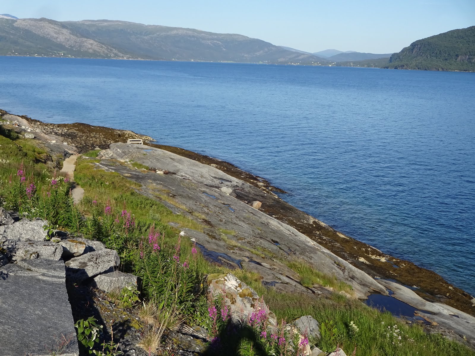
Once we'd disembarked we skittled off up the road to Tjongsfjorden which is an 11 mile long fjord that begins just west of the Svartisen glacier, and to get around it we were required to drive along 3 of it's sides, but as it provided another lovely parking area the long drive was no trouble.
 |
| Tjongsfjorden and Blokktinden Mountain |
 From there it was only a hop skip and a jump to the town of Jetvik from where our 2nd ferry left - and that was a much longer journey of about 15 miles, and one that took us back over the Arctic Circle. Therefore, from now on it should go dark at night - but not for long - today is predicted to be 19 hrs and 48 mins and sunrise tomorrow will occur at 3.17 am!
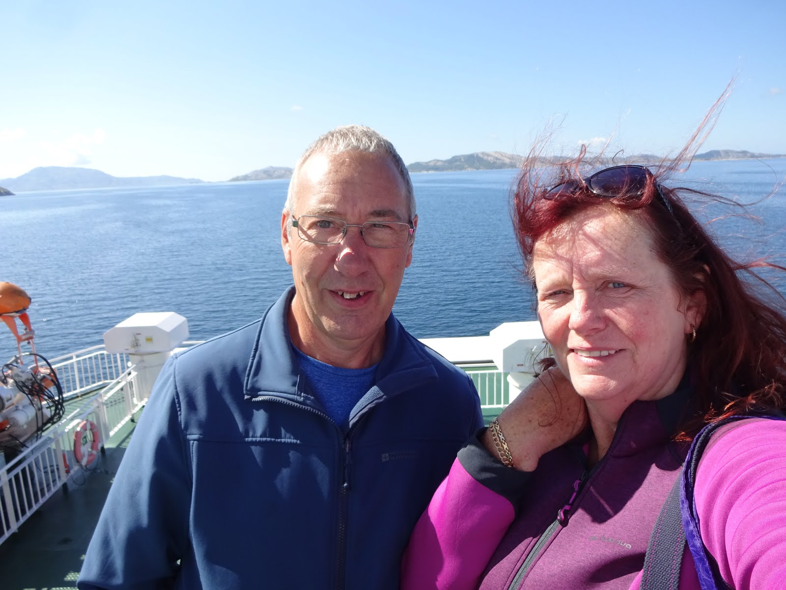 The pic on the right is the globe that marks the Arctic Circle latitude.
The crossing was like a mill pond (unlike the one we took from Lodingen to Bognes a few days ago), so it was lovely to sit on deck and watch the mountains slide by as we munched our lunchtime sarnies!
Then once we'd taken our second disembarkation it was back onto the FV17 but initially it was narrower and rougher than previously so our progression was a bit slower but it didn't really matter because our planned distance for today was only about 50 miles.
We broke our journey again at Gronsvik Kystfort which is a coastal artillery battery which was built between 1942 and 1945. On the site there's a museum and lots of old tunnels and gun emplacements that can be explored, and it also has fabulous coastal views which was mostly what we visited for.


 |
| The Hospital Chamber. |


 |
| Tonight's resting spot |
 |
| The water's edge for fishermen and picnickers! |
Friday 27th July 2018 🌞🌞🌞🌞🌞🌞🌞 - Roasting!
Mileage today 127 from Hellaga to Laksforsen Waterfall Parking area.
+ 5 ferry miles
Parking Co-ordinates 65.625, 13.292
This morning we left the Hellaga Resteplass and headed for our 3rd ferry on the FV17 route - this time only a short hop (5ish miles) from Nesna to Lavang, and then once back on terra firma we continued along the 'Kystriksveien' which our guidebook calls 'The World's most Beautiful Journey' - and we certainly wouldn't argue with that statement!
The first part of today's tour was taken up partially circumnavigating the fjord that we'd parked on last night and the opposite side provided a completely different view of our parking spot!
 |
| Your can just see the parking area centre bottom of the pic. |

Happily we just managed to squeeze into the picnic area/view point for it so that became today's lunch bistro!

Then following lunch we had a detour planned to go and meet Seven Sisters who have loitered near Route 138 for many millennia! Today they are seven magnificent mountains but they are so beautiful that local legend claims that they are female trolls who have been turned to stone! Botnkrona, Grytfoten, Skjaeringen, Tvillingene & her twin, Kvasstinden, and Stortinden were all daughters of the Suliskongen who kept them under strict control far up in the north of the country. One night he fell into such a deep sleep that all seven sneaked out to seek an adventure. But Vagekallen, who was seeking a wife was lying in wait! He chased them and the sisters fled south towards the coast with him and several other trolls chasing them. But none of them thought about the rising sun - which turns all trolls to stone if the're caught out in it - hence that is how the range that can be seen today was formed!

Our guide book advised that a fit walker could climb all seven in a day, and if they took up the challenge they'd climb 3,225 metres and cover 27 kilometres, so in today's rather warm temperatures we decided to give it a miss! Additionally, the several car parks were crammed so therefore we stayed at ground level and just admired them from afar!
Then it was back to the FV17 but only for a short while because we had another detour planned for the end of our day! We were now heading for Laksforsen Waterfall and to get there we needed to pop along Route 78 and then onto the main E6. However, while we were on the 78 we descended into our longest tunnel yet - 11 kilometres for which we were charged 85 Nok (about 8 quid). Now, as you would imagine it took a while to drive through, and while that was happening I took to pondering about where on earth would they put all the solid rock that had been bored out to make our ongoing journey possible. When you consider 11,000 metres x 7 wide and 6 high = ????? - that sums too hard for me but it would definitely be enough to build another mountain 😂😂!
Anyway, after that it didn't take long before we landed in Laksforsen Waterfall's car park - and it didn't take much longer after that for us to decide that we'd gone quite far enough for one day and that this would be tonight's resting place.

 The waterfall is stunning and apparently has a flow of 700 cubic metres per second with a fall of 17 metres. You can view it just from the car park which is what a lot of visitors seemed to be doing, but we scrambled down to the rocks and sat with the fall's spray and mist cooling us after our long drive in the heat of the day. Apparently the river is also one where you can see salmon jump - but I think any that could leap high enough to get above the waterfall would need a 🥇🥈🥉!
Oh - and just before I close for today - my beloved husband is being unkind to me again! We went for a quick look around the tourist shop and found a lady troll - he said it looked just like me when I get out of bed in the morning!
 |
| Tonight's sleeping spot |
Saturday 28th July 2018 🌞🌞🌞🌞🌞
Mileage today 90 from Laksforsen Waterfall to Torghatten Camping
Parking Co-ordinates 65.392, 12.09799
This morning we left the Laksforsen Waterfall behind and initially nipped back on to the E6 for a short while, and then on to Route 76 where we were cruising along admiring the scenery when something of a mishap occurred!

 |
| Poorly Wing Mirror |
The road was narrowish but T4rdis2 was proceeding along it quite nicely when suddenly a loud
'💥BANG💥' disturbed our tranquillity and scared me nearly half to death😱😱! A motorhome coming in the opposite direction wasn't keeping to his side of the road as much as he could (which we could later see on our dash cam footage) - maybe he was distracted by his need to wave at us! Our wing mirrors made contact at a joint speed of about 70 mph - and needless to say - our's broke! However, at that point of the road it was impossible for either of us to stop, and equally impossible for either of us to turn around to compare notes on the damage that had been done.
We assumed the other van must have sustained similar injuries to us, but luckily ours wasn't beyond repair. After a couple of hundred yards John managed to pull into a bit of a passing place to inspect the damage - the glass was crazed and the indicator was knackered but a bit of clear Gorilla tape quickly had it back to a functional state and we were able to continue our journey - and with hindsight, although it will be a bit costly to repair, we were just very grateful that it was only the wing mirror that was damaged.
Once we got going again we proceeded on to our planned destination which was Torghatten Camping which is a campsite that is close to the Torghatten Mountain that has a hole pierced right through it!

The campsite lies on Torget island and to get there more narrow roads needed to be traversed, and on our arrival we wondered if they would have room for us because it was really busy with lots of campers dipping in the adjacent fjord to cool off. But happily, 'yes' - we were soon pitched up and one of our primary reasons for being here was underway - our laundry hadn't been addressed properly for the last 3 weeks so you can imagine how big a heap it had formed! But that was almost an added bonus because the washers and dryers were included in the price of our pitch - therefore, several loads were completed in double quick time. But that took a big chunk of the afternoon, and delayed our walk up to the 'hole in the wall' until 5ish when some of the heat of the day had dissipated slightly.

 |
| From this angle it looks as if the floor is level but it actually drops away very sharply |
 |
| The precarious looking roof |


Once we reached the highest point of the cavern, which is on the land side, we clambered down through the cavity and out of the other side - and then we decided to make our walk into a circular one by descending down the sea-ward side, but if we thought going up was steep and difficult this side was worse! However, after about 40 mins of scrambling, at times using all 4 paws to maintain balance, we finally reached a path that was back at sea level and from there it was an easy stroll home!
Sunday 29th July 2018 🌞🌞⛅⛅⛅⛈⛈☁
Mileage 90 from Torghatten Camping to a Resteplass in the middle of nowhere! (Just of the FV17 on Route 775) + 4 ferry miles.
Parking Co-ordinates 64.61199, 12.359
This morning we left Torghatten without any real plan other than to catch the ferry from Vennesund to Holm and then continue southwards towards Steinkjer - but that was much further than we wanted to go all in one day, and we were slowed down by a bit of a delay at the ferry terminal. Up to now when boarding ferries we've been quite lucky and managed to get on the next available crossing. However, here the queue was long and the boat was small so one came and went leaving us and quite a few others behind! But it didn't really matter - I just stuck the kettle on and we had a cuppa while we waited.
The crossing was only a short one - about 25 mins - and that was probably a good job because at that stage the wind was howling so hard you could almost lean on it without falling over, and as we stood on deck clinging to the rail we got soaked with sea spray - but it was quite invigorating.
And other than that there isn't much to say about today. We drove along the FV17 for another couple of hours admiring the mountainous scenery as we went, and then as it neared 4pm we started looking for somewhere to stop for the night because we wanted to get settled before the predicted thunder storms and rain arrived.
 |
| Today's dining room for lunch |
We ended up in the 'Middle of Nowhere' really - its a picnic spot just off the FV17 on Route 775 where we have the company of a couple of other vans and hopefully where we'll catch a quite nights kip!
So until next time - take care 😙
Click here to see our Norwegian camping spots