Mileage 41 from Camaret on the Crozon Peninsula to Camping la Pointe near Chateaulin
Parking Co-ordinates 48.18724, -4.08504
At the mo we're nicely settled on our first campsite of this trip (the previous 47 days have either been on Aires or wild camping), and it's located just outside the town of Chateaulin. We're still within the Armorique National Park, and also almost right on the banks of the Nantes Brest Canal which runs for a total length of 239 miles and links the two seaports of Nantes and Brest through inland Brittany.
Our plan for coming here was to have a bit of a rest and to catch up with a few chores that we've neglected while we've been on the road, however in our 3 full days here we've still managed to cycle 30 miles, walk 8 and cycle 16 respectively😂😂😂 but at least that's made it so I've got a bit to tell you about!
 |
| Heading towards Chateaulin with the Church of Notre Dame in the background. |
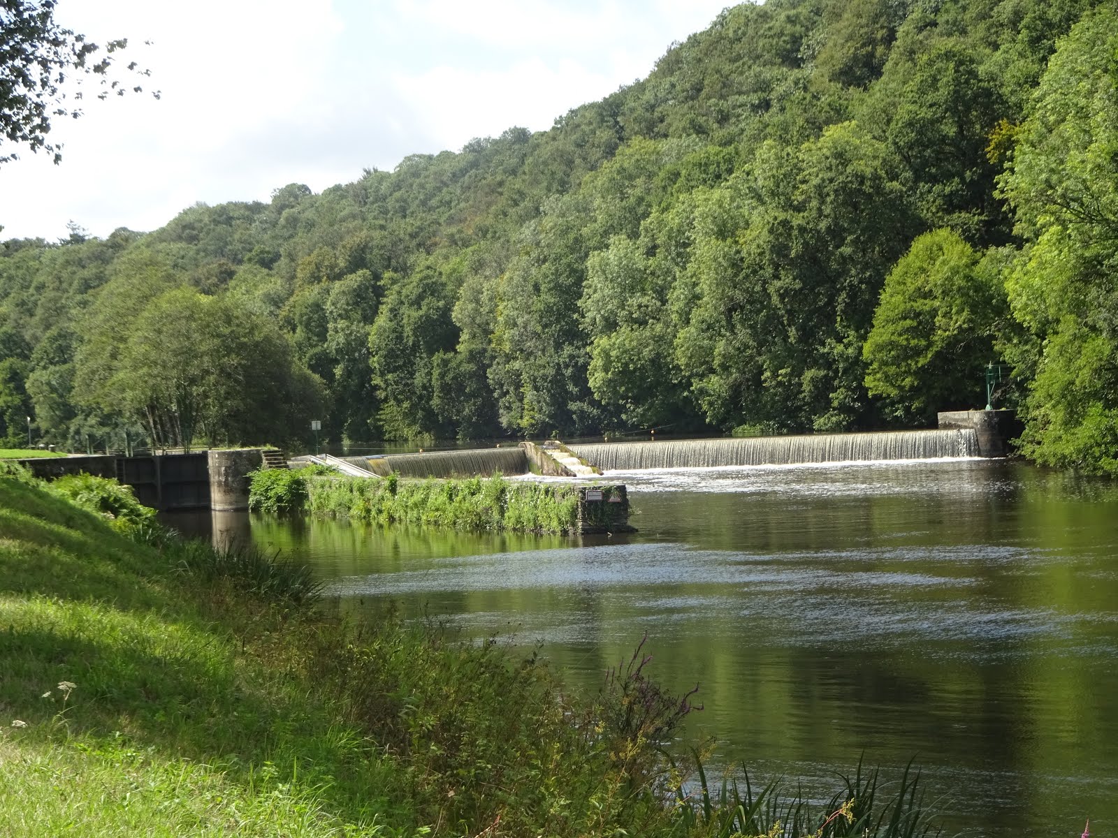 |
| Just one of the locks most of which have a canoe shoot, a fish ladder and a sluice gate across their width |
 |
| Built in the 16th century with bits added in the 18th |
During our travels we've visited a huge number of churches but this one interested us because it had a 'Complete Parish Close' which is a series of structures that are unique to this region of Finistere! A Parish Close is a sort of cemetery that also includes an Ossuary (a bone house). It seems that such was the pressure on patches of hallowed ground that every 5 years or so old corpses where exhumed to make room for new ones and the bones were then placed in the Ossuary. When that in turn became full all the bones were given a grand ritual burial in a common grave!
 |
| Part of the Calvary at Pleyben |
Many of the old churches in this area also have intricate Calvaries along side them. These are 16th century elaborate sculptures detailing biblical scenes such as The Nativity and The Last Supper, so as we weren't likely to find these things anywhere else we felt we should take the time to look while we were here!
From there we trekked onto the sea lock at Guilly Glaz which was constructed around 2006 as part of a flood prevention scheme. The cost was 6 million euros (which came from Europe!) and although it wasn't expected to completely eliminate flooding it's aim was to limit it to less devastating occurrences and for shorter periods.

 |
| The 12 arch railway viaduct that comes just before the lock |
Then on Tuesday John had planned a fairly long hilly ride to the view points on the highest hills in the Armorique park (The Monts d'Arree) - but we decided we were knackered😩😩, so instead we settled for a much shorter and flatter outing along the Aulne River again. And when we got to our planned picnic destination we sat and watched for wildlife of which there is supposed to be plenty! But they must have seen us coming or maybe they were having a siesta 'because not a creature was stirring, not even a mouse!' But Hey Ho it was lovely to watch the water gently flowing in the very warm sunshine, and when we'd done with that we nipped home to enjoy a cold beer along with a few more rays!
Wednesday 21st, Thursday 22nd and Friday 23rd August 2019 ⛅⛅⛅🌞🌞🌞🌞
Mileage 25 from Chateaulin to Huelgoat.
We've been to Huelgoat before - probably about 15 years ago when we stayed in a friend's Gite - but neither of us can remember it very well! The name Huelgoat translates to mean 'high wood' and it seems it's one of Brittany's last remaining forests (covering about 1,500 acres), but back in October 1987 many of the old trees were lost when gales ripped through and smashed them to matchwood all within the space of about 15 minutes!
We're parked in the town's free Aire and our plan is to stay for 3 nights so that we can do some 'revision' and re-explore the area both on foot and bike, and according to our guide book (and John's map searches) there's plenty of tracks and trails to keep us busy.
By the time we'd arrived on Wednesday it was lunch time, but once that was consumed we set off for a 5 mile walk that started within the village at a place called Chaos du Moulin - a mass of huge boulders covered in moss and tangled in with lots of fallen trees and wild vegetation.

The origins of the boulder field (which is extensive) date from around 340 million years ago when a large mass of magma formed several kilometres below the surface. This mass was called the Armorican Massif and over time cold and ice fissured it allowing water to enter. The water froze within the cracks and chunks of rock broke away, then following more erosion they eventually came to the surface leaving behind this tourist playground. The whole area is filled with mossy tumbled boulders that have been worn smooth with weather and water, and have formed structures like the Grotte du Diable (The Devil's Cave) which was right at the beginning of our walk!

 The way down into it was via a steep ladder, and the cave is so named because it's alleged that in the far distant past a fleeing soldier spent a night there and he protected himself with a pitchfork. As you'd imagine, when the locals saw his shadow in the firelight they had an understandable fright!
 There were loads of other 'Named' rock formations, and once again it was possible to use your imagination to see all kinds of objects and creatures in this enchanted wooded area that was made all the more magical by a harpist strumming music that suited the setting perfectly! However, even though the woods are supposed to be home to creatures such as roe deer, squirrels and martens, along with birds such as woodpeckers, falcons, owls and woodcocks all of the above remained absent but that probably wasn't surprising due to the very large number of people and sproglets that were exploring and scrambling over the rock formations!


But in one place we were quite happy to find other folk to take the strain! It seems that if you pushed hard enough on 'The Trembling Rock' it literally rocked😱 and we saw it move!


 On Thursday we toddled out on our bikes to ride along part of an old railway line that has been converted to form the V7 Voie Verte cycle way which is 147 km route that links Roscoff on the English Channel with Concarneau on the Atlantic coast. The part that we rode was from just outside Huelgoat in a northerly direction for 15 miles and that landed us in the middle of nowhere 😂😂, or if you prefer, at the Gare de Kermeur which was originally an old station. On our way we'd passed 3 old gypsy style horse and carts with holidaying French families in them and it seems that this was one of there 'watering holes' where they would stop to spend the night!
Once we'd been fed and watered we mounted up again and got underway, but at that point I told John I was 'feeling a bit tired'💤! 'Not to worry' he said 'cos we've only got one hill to go up' - but what he didn't mention was that although the hill wasn't particularly steep, it went on for 4 miles! On the way we passed by the ruin of The Chapelle Sainte Barbie and then it was pay back time because not long after we reached the top of the hill and then the corresponding down took over 😁!
But once again I have to report that my husband tells great big 'Porkies' cos there was still one more long hill to ascend before we scuttled around Huelgoat lake on our way home!
 On Friday we walked again - this time about 6 miles around The Circuit Decouverte which translates to The Circuit of Discovery! But to be honest there wasn't really very much to discover. The trail led us along a raised track with a narrow disused canal on one side and a tumbling forested downhill slope on the other, and for some of the way we had the company of the River d'Argent as it gushed and tumbled along the valley floor. Here some of the damage from the 1987 storms was still evident because most of the trees were younger ones and the old fallen stuff was still there but covered in tangled vegetation, moss and thick brambles.


A couple more pics from along our way show a fairly big tree stood high on a rock, and another boulder formation that was aptly named Le Champignon! The walk itself wasn't particularly spectacular but on this very warm day, walking in the woods provided lots of dappled shade and it was just far enough to say we'd put some effort in!
Tomorrow we're going to move back to the coast because the weather forecast is for '🌞🔥🌞🔥🌞🔥' (30 degrees), so once there we're hoping we'll catch a bit of breeze - but we'll let you know next time!
Cheerio for now 😙😙
Click here to see all 127 of our French camping spots
 |
| The town of Huelgoat as viewed from across the lake |
By the time we'd arrived on Wednesday it was lunch time, but once that was consumed we set off for a 5 mile walk that started within the village at a place called Chaos du Moulin - a mass of huge boulders covered in moss and tangled in with lots of fallen trees and wild vegetation.

The origins of the boulder field (which is extensive) date from around 340 million years ago when a large mass of magma formed several kilometres below the surface. This mass was called the Armorican Massif and over time cold and ice fissured it allowing water to enter. The water froze within the cracks and chunks of rock broke away, then following more erosion they eventually came to the surface leaving behind this tourist playground. The whole area is filled with mossy tumbled boulders that have been worn smooth with weather and water, and have formed structures like the Grotte du Diable (The Devil's Cave) which was right at the beginning of our walk!

 The way down into it was via a steep ladder, and the cave is so named because it's alleged that in the far distant past a fleeing soldier spent a night there and he protected himself with a pitchfork. As you'd imagine, when the locals saw his shadow in the firelight they had an understandable fright!


But in one place we were quite happy to find other folk to take the strain! It seems that if you pushed hard enough on 'The Trembling Rock' it literally rocked😱 and we saw it move!


 On Thursday we toddled out on our bikes to ride along part of an old railway line that has been converted to form the V7 Voie Verte cycle way which is 147 km route that links Roscoff on the English Channel with Concarneau on the Atlantic coast. The part that we rode was from just outside Huelgoat in a northerly direction for 15 miles and that landed us in the middle of nowhere 😂😂, or if you prefer, at the Gare de Kermeur which was originally an old station. On our way we'd passed 3 old gypsy style horse and carts with holidaying French families in them and it seems that this was one of there 'watering holes' where they would stop to spend the night!
 |
| I only managed to catch a rear view but the children looked very bored! |
 |
| The Chapelle Sainte Barbie (but neither she nor Ken were in😂😂) |


A couple more pics from along our way show a fairly big tree stood high on a rock, and another boulder formation that was aptly named Le Champignon! The walk itself wasn't particularly spectacular but on this very warm day, walking in the woods provided lots of dappled shade and it was just far enough to say we'd put some effort in!
 |
| Another pic of Huelgoat |
Cheerio for now 😙😙
Click here to see all 127 of our French camping spots
No comments:
Post a Comment