A Short Tour to Boroughbridge and the Lakes - Part 2
Hello again 👋👋! Our last instalment ended on Friday 20th May with us exploring parts of Whinlatter Forest and it was a good job we'd made use of that bit of good weather because the next couple of days were a bit of a washout with regard to our activities 🌧️ 🌧️ 🌧️!
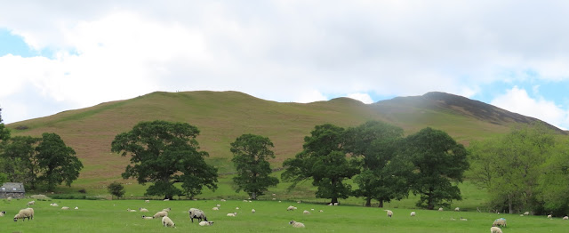
On Saturday 21st May John decided that we should attempt an ascent of Grisdale Pike, a hill (or a Wainwright as they are called here in the Lake District) which stands at 2,595 feet and to which we could walk to right from our doorstep. However, we didn't make it but before we gave up we had at least 4 miles under our belts trying!

The weatherman had assured us that there might be some short sharp showers around 11ish but as we left the campsite and started to tramp ever upwards heavy rain started to pour almost in a horizontal direction, and even though we've got very good waterproof gear there was absolutely no pleasure in the battle that we seemed to be facing! And additionally, there might even have been a degree of danger ☠️ in the form of very slippery slopes ☠️ !
Therefore, after a couple of miles and as we gazed at the very steep scree slopes of the Pike itself we decided we'd had enough! But would you know it? By the time we got back to the van the sun shine 🌞🌞🌞🌞 had won the battle and it was one of the best afternoons we've had so far - fantastic for lazing outside the van while sipping a cider of two🍻
Sunday, in biblical terms, is meant to be a day of rest, and that's more or less exactly what the 22nd turned out to be because from before dawn and until about 6pm the rain lashed down with furious ferocity, so for the most part it was definetely a duvet day😊!
But, not to be outdone, on Monday we decided to have another go at Grisdale Pike but this time we planned to attack it by walking our circular route in the opposite direction!
 |
Near the beginning of our walk we could look down at our campsite! Our van is
at the back of the green field slightly right of the middle of the picture. |
However, once again, we didn't make it because after a good couple of miles of slogging steeply uphill we came to a crossroads where we had the choice of turning right to Grisdale or left to ascend Crag Hill, and it was at this point that John realised that Grisdale wasn't the tallest peak in the area! That honour was Crag Hill's (and that was the peak we chose) which stands nearly 200 feet higher at 2,749 feet, but that required at least another hour's worth of 🐌pace climbing 🐌to reach the summit.
 |
| And it was definetely very wild and windy when we got there. |
However, the views were stunning despite the fact that the mist and low cloud kept floating in to obscure them!
 |
| A view back to the first couple of miles of our walk |
 |
And a view of the Scar which would lead us on to a hill called Sail
and that was where we were heading"
|
We picnicked on the top of Crag Hill sheltering from the fierce wind as best we could before setting of steeply down onto a ridge called the Scar from where we could look down into valleys on both sides.
This trail eventually let us to the base of Sail Hill, but to get to the top of that all four paws were required to scramble up!
Then, as I've said before, what goes up must come down, so it was another slippy slidey decent over more scree before we reached a zig zag path that we thought might make for easier walking but the rolling stones along it's length required great care to avoid going 'bottom over boob'😂
Altogether our walk was probably only about 10 miles but with all the steep climbing it felt much more and we were certainly glad to get home for a cuppa!
So after such an exhausting day yesterday we decided we might have an easier one on Tuesday - and although we didn't ascend much in height we nearly matched it in distance! We toddled into Keswick to do a bit of gear shopping, and then down by the side of Derwent Water to view it from a different perspective!
 |
| A View Across the Calm Waters of Derwent Water |
 |
| From our picnic spot by the lake we could see Crag Hill top which we'd climbed previously! |
 |
| The Millennium Stone which sits on the shore of Derwent Water. |
Wednesday 25th turned out to be rainy in the morning and very blustery 🌀 in the afternoon with the weatherman suggesting gusts might reach 40 mph! Therefore, we stayed snug in our van in the morning and satisfied ourselves with just a 🌬️short blow 🌬️ in the afternoon to ensure we hadn't got any 🕸️!
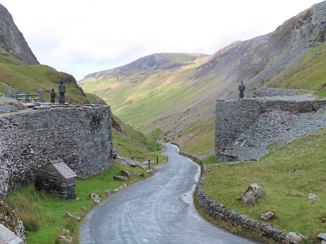
Thursday dawned much the same as Wednesday but by mid-day the dark skies were clearing but the gale force winds were persisting. However, after being stuck inside for most of yesterday we were quite determined to go out and enjoy ourselves today, and for that we chose a drive over Honister Pass and a visit to The Pass's famous Slate Mining area!
 |
The view for the National Trust Car Park back down the way we had just come up!
|
But we didn't go down into the cold dank dark mine; instead we climbed another very steep stony hill which led us up very high and from where we could gaze back down to the visitors centre!
 |
While we were in the Visitor's Centre I was going to by some coasters
for our new home but I thought 50 quid for 4 small polished bits of slate was a bit steep!!! |
 |
| Outside the Visitor's Centre there were loads of sculptures all crated from the mine's Slate. |
 |
| John - nearly at the top of our climb near the Honister Visitor Centre |
 |
And me - nearly at the bottom
|
 |
| And all the time we were there we were surrounded by waterfalls gushing off the high hills. |
 |
| Then as we left the mine area this was our way forward |
 |
And this was our coffee and cake stop surrounded by the high rocky hills.
All the way down the scenery was mesmerising and although it was bleak it was
very beautiful
|
We finished our day by passing Lake Buttermere and walking around part of Crummock Water - all very peaceful and tranquil!

On Friday we needed shopping but before we got stuck into that chore we visited the Keswick to Threlkeld Railway Trail which is a perfect tarmac multi purpose track that runs for about 3 miles (so our there and aback walk was 6.) However, it hadn't always been so pristine because back in 2015 storm Desmond flooded the River Greta (which runs along side the trail) and caused havoc that destroyed the path in many places, and it wasn't until 2020 that it was fully restored.
A short way into our walk we came across The Bobbin Mill Tunnel which had it's own history to tell! In 1970 it was infilled and sealed to prevent any collapse which might damage or weaken the foundations of the huge road viaduct (for the A66) that had been built above it, and in 1999 that structure won the 'Best Civil Engineering Structure of the Century'. However, after Storm Desmond the tunnel was reopened following 4,000 tones of rubble being removed along it's 80 metre length.
There was also lots more industrial history along the way, but in these more modern times the route forms a small section of the C2C cycling trail that runs for 137 miles from Whitehaven on the Irish Sea to Tyneside on the North Sea (and that was a cycle trip we made about 11 years ago)
But today's outing was a much more restful, and one where we took our time to sit beside the River Greta watching the wild life as we tucked into our picnic!
Our plan for Saturday had been to complete a bit more of the
Coledale Horseshoe part of which we'd already done last Sunday. However, when we rose from our beds we both felt a bit weary so we decided to postpone that challenge until tomorrow and to award ourselves a day of rest and laziness for today 😴😂
So on Sunday morning, which dawned bright and sunny, we rose ready for our challenge! We set of from the campsite and trundled up a hill called Barrow, the top of which is at 1,494 feet.
 |
The rise onto Barrow starts on the left of the pic and the slope looks fairly
tame - until your actually on it! However, it has to be said, this was
probably the easiest ascent of the day😳 |
Next came Scar Crags which elevated us further to 2,205 feet but in between the ups there were also downs - so this required us to re-climb some of the height we'd lost!
 |
| John admiring some of the magnificent views! |
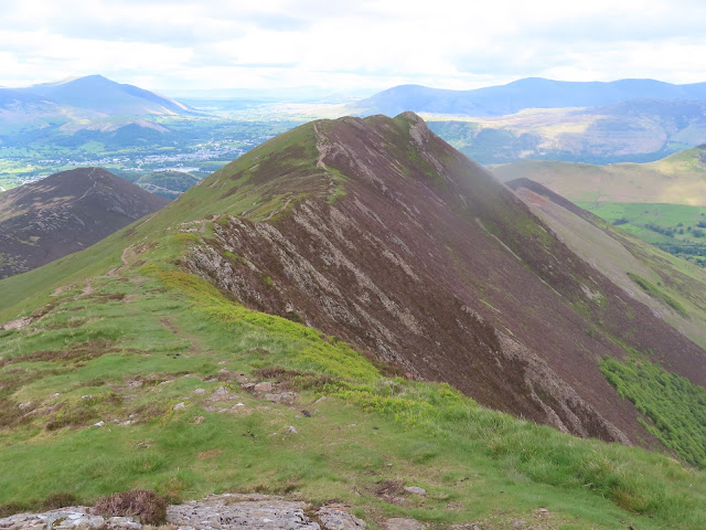 |
The Ridge leading us on towards Causey Pike
|
And once we got onto the top of Causey Pike which stands at a height of 2090 feet I realised I'd absolutely on reason to worry about my eyesight!
 |
From where we stood on the top of the hill we could see all the way to
Dumfries and Galloway in Scotland and also the waters of the Solway Firth |
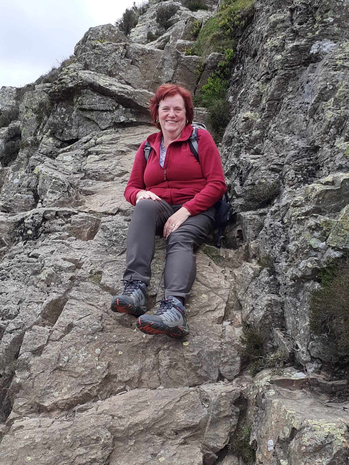
However, it was at this point that there was a slight problem! Having achieved all that height we had to get down off Causey Pike and to do that we needed to scramble down a very steep and craggy rocky face which dropped for about 300 feet!

 |
This certainly required 3 points of contact at all times and to
achieve that I had to employ 'ones' that I don't usually use when out walking! |
John was also a bit concerned because if I hadn't managed to get down he might have had to cook his own tea😘
And even once we got to the bottom of that steep drop the going didn't get much easier because then we had about a mile or more to continue downhill over a steep rocky path called the Flank of Rolling End and on this part of our walk the stones often rolled under our boots causing slips and squeals (from me) as we went!
 |
| Causey Pike |
Eventually, the path dropped us back down onto the road near Stoneycroft in the Newland's Valley and from there we just had another mile and half of easy walking to get back to the campsite. Overall this route had been a mixed bag of very steep ascents, rocky paths and sometimes near shear rock faces that had to be scrambled down very carefully, but in the end we both agreed it was probably the best walk we'd been on.
Monday was our penultimate day of this tour and our plan had been to walk into Keswick for lunch. However, right from the 'get go' the rain had pitter pattered on and off, and additionally we'd both got tired legs from yesterday! So in the end we opted for a quite day in and just passed our time doing a bit of cleaning and packing ready for our trip home tomorrow, and while we're there we'll be staying on our usual caravan site at
Butterley Bank!
But we wont be 'home' for long because it's only a little over 2 weeks before we set off for the
Cud Life in Yorkshire!
Bye for now👋👋


No comments:
Post a Comment